Ennedi Region (Ennedi Region)
Per the census of 2009, the population of the region was 173,606, 45.20 per cent female. The total number of households was 24,784: 23,977 in rural areas and 807 in urban areas. The number of nomads in the region was 27,759, 7.20 per cent of the population. The sex ratio was 121.00 females for every hundred males.
Per the census of 2009, the population of the region was 173,606, 45.20 per cent female. The average size of household as of 2009 is 5.90: 5.90 in rural households and 5.40 in urban areas. The total number of households was 24,784: 23,977 in rural areas and 807 in urban areas. The number of nomads in the region was 27,759, 7.20 per cent of the total population. There were 146,913 people residing in private households. There were 70,730 above 18 years of age: 38,011 male and 32,719 female. The sex ratio was 121.00 females for every hundred males. There were 145,847 sedentary staff, 1.40 of the population.
Map - Ennedi Region (Ennedi Region)
Map
Country - Chad
 |
 |
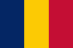
| Flag of Chad | |
Chad has several regions: a desert zone in the north, an arid Sahelian belt in the centre and a more fertile Sudanian Savanna zone in the south. Lake Chad, after which the country is named, is the second-largest wetland in Africa. Chad's official languages are Arabic and French. It is home to over 200 different ethnic and linguistic groups. Islam (55.1%) and Christianity (41.1%) are the main religions practiced in Chad.
Currency / Language
| ISO | Currency | Symbol | Significant figures |
|---|---|---|---|
| XAF | Central African CFA franc | Fr | 0 |
| ISO | Language |
|---|---|
| AR | Arabic language |
| FR | French language |


